
Revolutionary War-A New and Correct Plan of the Town of Boston - Published in the Gentlemans Magazine, London 1776
Revolutionary War - A New and Correct Plan of the Town of Boston published in the Gentleman’s Magazine, London 1776
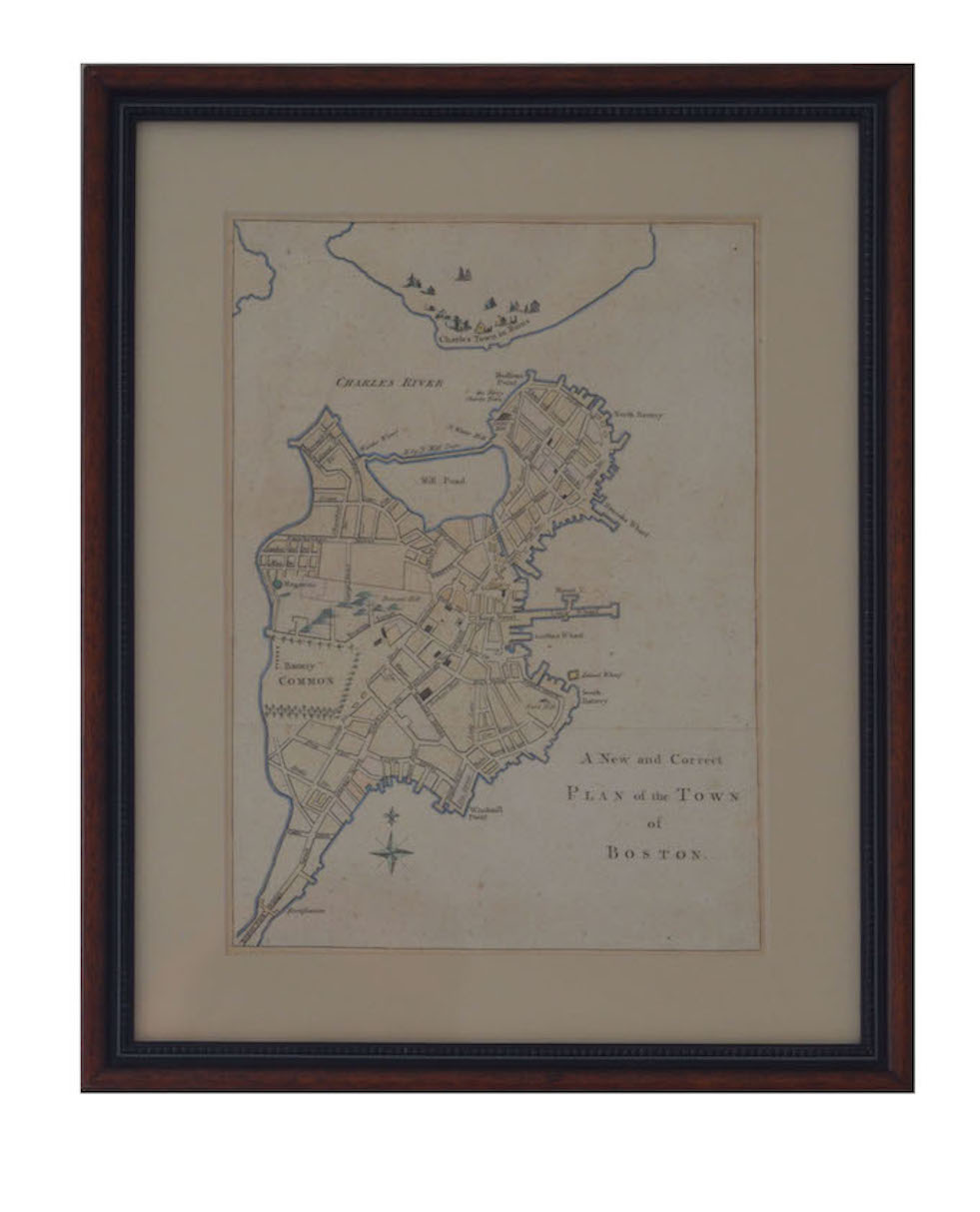
Beautiful hand-colored Plan of Boston published October 1776 in The Gentleman’s Magazine, London. It was one of three maps inserted into consecutive magazine issues designed to illustrate “a perfect Representation of the present Seat of War in America.” The map details streets, street names, and landmarks such as the Liberty Tree and Long Wharf, numerous fortifications and encompasses “Charles Town in Ruins” razed in the battles of Lexington and Concord and The Battle of Bunker Hill.
By 1775 the American Revolution was well underway; in the spring of that year skirmishes broke out in Boston -known as the Battles of Lexington and Concord and the Battle of Bunker Hill. Within days following the Battle of Bunker Hill the British army in Boston was under siege by the nascent Continental Army directed under the newly appointed Commander in Chief George Washington subsequently resulting in the British troops retreat from Boston.
Description/Condition
(HxL) 14 ½ ” x 11 ¾” Frame
(HxL) 10 ¼ ” x 7 ½ ” Document site
Beautiful hand-colored Plan of Boston printed on Laid paper; very good condition no stains, rips or tears; wonderful aged overtone; illustrations are crisp, fold lines original to magazine insertion, left upper quarter soft wrinkles;
This particular Plan has become increasingly scarce and is highly sought- after among experienced collectors
Email: jtfrancis.com@gmail.com
Item: 19-21-06
![]()


